Map Arlington 1: Extracting OSM Data for a Localized Map Server
The Problem
OpenStreetMap (OSM) is collaborative map of the world, freely available to anyone to use and contribute to its development. Planet.osm has information on downloading the database, which at the time I’m writing this was 71.4GB for the data in PBF format.
I wanted to create a map server for my local community of Arlington County, Virginia. In the first part of this case study I’ll document how I got OSM map data into PostGIS.
Creating the Database
I’m working on an Debian 12 (Bookworm) server with PostgreSQL 15 and PostGIS 3.3 installed. These tools can be installed with the following command:
$ sudo apt install postgis
To allow external connections to the database, I edited
/etc/postgresql/15/main/pg_hba.conf and changed:
host all all 127.0.0.1/32 scram-sha-256
to:
host all all 0.0.0.0/0 scram-sha-256
and then edited /etc/postgresql/15/main/postgresql.conf and changed:
#listen_addresses = 'localhost'
to:
listen_addresses = '*'
and then finally ran the following command to restart the database server and have these changes take effect:
$ sudo service postgresql restart
Next I gave my user database superuser privileges and set its postgress password with:
$ sudo su - postgres
$ createuser --superuser [user]
$ psql -c "ALTER ROLE [user] PASSWORD '[password]'"
$ exit
so I could create a database with:
$ createdb map_arlington
$ psql -d map_arlington -c 'CREATE EXTENSION postgis'
I installed this postgres server on a
KVM using
virt-manager. On
the 192.168.122.x network that virt-manager creates, this server had
address 192.168.122.19. To verify I could connect to it I ran:
$ psql -h 192.168.122.19 -p 5432 -U jelkner -d map_arlington
When greeted with:
map_arlington=#
I knew I was ready to go.
With a spatial database created, now it’s time to get the data.
Getting the Data
The German company Geofabrik provides a mirror of Planet.osm data broken down into localized parts, including countries and states in the U.S.. Their Virginia page has a link to 215 MB file (at the time of this writing) containing recent data for the state of Virginia.
I downloaded this with:
$ wget http://download.geofabrik.de/north-america/us/virginia-latest.osm.pbf
While 215 MB isn’t unmanageable, for this project I’m only interested in the small part of that data that contains Arlington County. Osmosis is a command line Java application that can extract data from a PBD file within a specified bounding box.
To find the bounding box for Arlington County, I used an web application appropriately named BoundingBox at http://boundingbox.klokantech.com.
With the bounding box determined, I installed osmosis and used it to
the PBF data for Arlington County:
$ sudo apt install osmosis
$ osmosis --read-pbf file=virginia-latest.osm.pbf --bounding-box top=38.9342803955 left=-77.1723251343 bottom=38.8272895813 right=-77.032081604 --write-pbf file=arlington.osm.pbf
17193 milliseconds later I had a 6.6 MB file with Arlington County PBF data.
The next step is loading this data into the PostGIS database.
Loading the PBF Data into PostGIS
To import the PBF data into the PostGIS database, use osm2pgsql, which can be installed with:
$ sudo apt install osm2pgsql
After installing osm2pgsql, loading the data into PostGIS can be done with:
$ osm2pgsql arlington.osm.pbf -d map_arlington
Viewing the Database in QGIS
QGIS provides a quick and easy way to view the spatial data in a PostGIS database. After loading the data with imposm, I connected QGIS to it:
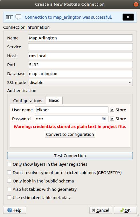
and took a look:
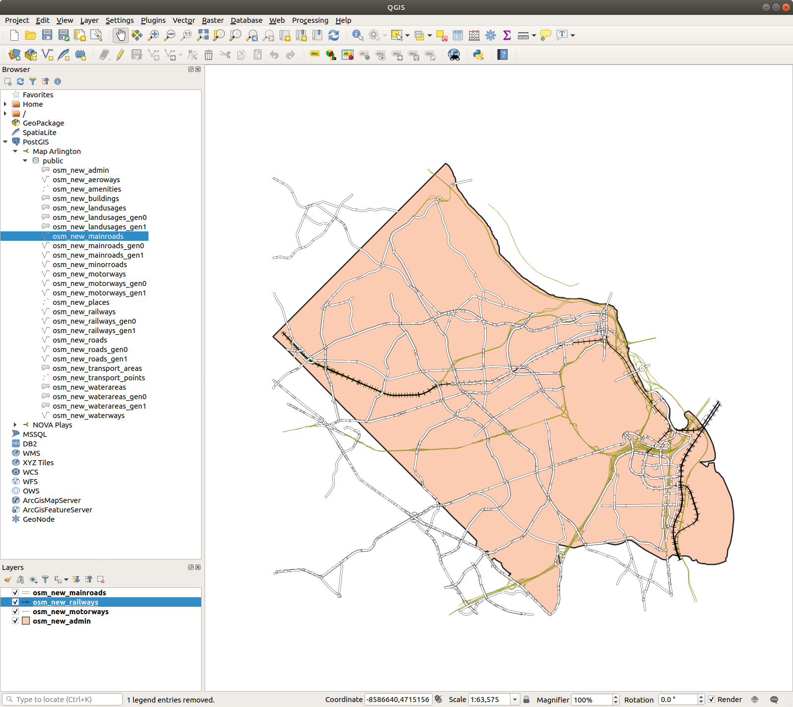
Note
The osm_new_roads layer reported an error when I tried to load it. This
didn’t happen when I originally wrote this a few years ago.